
When we talk about spatial planning, we tend to consider the urban landscape as a physical arrangement defined by objects, voids and their visible relations. For decades, the field of urban morphology has sought to unveil, measure and study these relations, in order to learn more about the evolution of the city form.
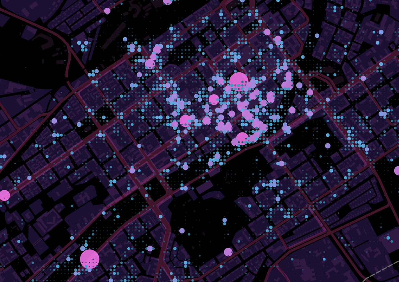
This workshop explores the landscape of the invisible city, using digital traces to unveil, measure and study the meta-morphology of the city. Participants will use location-based social media data to carry out GIS surveys and observation-based spatio-temporal analyses of activity patterns in London (area to be defined). We will focus in particular on Instagram data. Participant will be divided into two groups: one will use geolocated Instagram pictures to analyse spatio-temporal patterns in GIS, while the other will carry out a qualitative analysis on a sample of Instagram pictures originally taken in a selection of public spaces. Together, the two groups will investigate the relation between the digital and physical landscapes, while highlighting the relevance of location-based social networks for urban and transportation planning.
Aim
All around Europe, we are witnessing a large-scale renewal process of former industrial areas, very often located in the very centre of inhabited urban areas. The main challenges for many of these projects does not just involve architectural conservation and urban design, but also the creation from scratch of an environment for social and economic activities. In other words, creating new life in the city where there was none before.
Fifty new buildings, 2,000 new homes, and 20 new streets, on a surface of 67 acres, will host 45,000 people in a new multi-functional urban development in central London: these are the figures behind King’s Cross Railroad Yards and their project, designed to instil new urban life into a former industrial site. But how does this reflect onto our social life? How will the new development influence the surrounding areas? How popular and well-received is the new development, compared to its surroundings? Is the new development capable to benefit the surrounding areas? Are the 26 acres of public space going to be socially effective? What does the digital footprint of new urban developments look like?
In this workshop, we will try to address to these questions by studying the invisible urban structure of a newly born neighbourhood. We will use Instagram pictures to observe the birth of social life in the new development, and how this will affect, or not, the perception of the public space.


Requirements
The workshop is open to all, although it is mostly targeted towards architecture and planning professionals. Non-profit organisation, active citizens or students of other specialities are welcome to join us, as they can complete the tasks by working together with those who are more familiar with the concepts and techniques involved.
Participants are required to bring their laptop and install the following programs prior to workshop:
- QGis | http://www.qgis.org/en/site/
- JOSM | https://josm.openstreetmap.de/
Expected outcomes
The workshop will produce a set of maps to display spatio-temporal patterns in the Kings’ Cross area, and a short survey of the image of the city as it is perceived through Instagram pictures. Participants will then present their results to open a short discussion, focused on answering the questions proposed above or suggesting new questions for further study.
Furthermore, since the King’s Cross development has not been fully delivered yet, the results of this workshop may establish a benchmark for comparison that can be reviewed and updated once again when the whole development process is completed.
